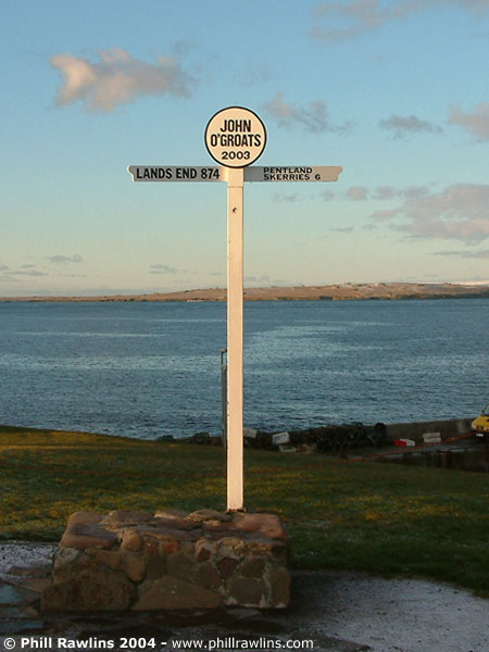
The most northern point on mainland Britain, John O’Groats is the obvious place to start when touring this area. Many people start here, having travelled the A9 up to the north east corner of Scotland, but by the time they reach John O’Groats they have passed some of the best scenery in the UK.
A few miles to the west lies Dunnet Head and the town of Thurso. The area is great for walking and relaxing, with quiet roads and clean crisp air, and some of the best coastal scenery in the UK.
The photographs on this page are a selection taken in 2003.
What there is to see
Caithness is a low, flat county that ends abruptly at the sea. It is not the mountainous Highlands that most visitors expect: the land is mostly flagstone moor and farmland, and the drama is all in the coast, which is among the most exposed in Britain.
Four places account for most of what people come to see. John O’Groats is the village at the north eastern tip, famous for its signpost and for being the end point of the journey from Land’s End. Dunnet Head, a few miles west, is the actual most northerly point of the mainland, and looks across the Pentland Firth to Orkney. Duncansby Head is the north eastern corner, with the Stacks of Duncansby standing in the sea below its cliffs. And the Castle of Mey, west of John O’Groats, was the Queen Mother’s home in Caithness.
The sea
The Pentland Firth separates Caithness from Orkney and is one of the most treacherous stretches of water around the British coast, with tides running at up to sixteen knots. From Dunnet Head you can watch it work: the water is never still, and on a clear day the island of Stroma sits in the middle of it, abandoned since the last families left in 1962.
It is a landscape for long walks, low light and weather that changes quickly. The photographs here were taken over a short stay and are mostly of the coast, because that is what the place is.